
Trace a Fort Lauderdale Street
Start with the address, not a guessed name. Fort Lauderdale uses compass quadrants, numbered roads, and named corridors, so NE 1st Street and NW 1st Street lead to different land. The standardized site address in the Broward County Property Appraiser record is the sound base. It links a place to a folio, owner, legal description, and sales clues. Each later step answers a narrower question. Ownership, voter registration, permit responsibility, and a telephone listing are different facts.
- Enter the full street number, directional, and name in BCPA. Save the owner spelling, folio, situs address, mailing address, and legal description.
- Open the City of Fort Lauderdale Property Information Reporter. Select the match, zoom to the parcel, and click the lots on both sides and across the road.
- Use each folio or owner name in Broward Official Records. Check deeds against the same legal description before linking a person to that land.
- For registered voters by street, use the Supervisor of Elections public-report channel. Keep protected and unregistered people outside any conclusion.
- For an earlier listed adult, consult a reverse or criss-cross directory at the library. Confirm that historical clue with deeds, census schedules, or newspapers.
This sequence turns a Fort Lauderdale by-address search into an audit trail. A changed mailing address may reflect an entity, trust, seasonal owner, or agent. It does not prove why the mail goes elsewhere. Likewise, homestead status may support owner occupancy for a qualifying tax year, but it cannot name every person at the home.
Fort Lauderdale Street Search Fields
BCPA is the county's key address-to-owner bridge. Its portal has several modes, yet Property Search is the right first stop for a normal street address. Exact spelling helps. If the street form fails, try the portal's standardized version or use the folio from a map result. The result page can carry enough data to distinguish two similar sites before any deed search begins.
| Search control | Input | Use in a street search | Result clues |
|---|---|---|---|
| Owner name | Text | Find all parcels under one recorded owner spelling | Owner and mailing address |
| Street address | Number and street | Convert one site into an official parcel | Site address and folio |
| Folio or parcel | Identifier | Carry the same land across systems | Legal description, use, values |
| Search modes | Property, sales, subdivision, land and others | Expand from one parcel to related land evidence | Sales, deed references, maps and aerials |
A parcel result also may show exemptions, building traits, tax links, municipality, and sales instruments. These are parcel facts. The owner mailing address is where tax notices go, while the situs address is the physical land searched.
Browse Fort Lauderdale Parcels
The Property Information Reporter adds the shape and civic context that a plain roll lacks. Enter an address, choose the standardized match, and zoom until parcel outlines appear. Clicking nearby polygons supports a parcel-by-parcel walk along the block. Available layers include tax parcels, site-address points, neighborhood associations, zoning, school and police districts, future land use, historic districts, and historic properties.
Permit and code data may update daily, while other layers may update weekly, monthly, annually, or only after a boundary change. The City GIS FAQ directs users to a public-record request when a needed map or dataset is not offered. It also matters that some reports are city-only. A postal address that says Fort Lauderdale may sit outside municipal limits.
The successful City GIS source below shows how Fort Lauderdale explains its map data and request fallback.
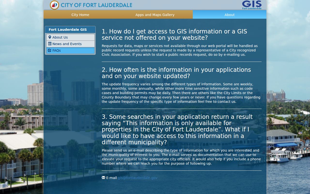
The viewer is best used as a visual bridge, with the folio saved before moving into county records.
Fort Lauderdale Records by Street
No official by-street source lists every occupant. Instead, Fort Lauderdale address research draws from several record sets, each with a defined keeper and limit. The folio ties property and recorded instruments together. The normalized street address ties the parcel to maps, permits, and code cases. Voter and reverse-directory evidence adds people only within the scope of those sources.
| Address source | Public keeper | Evidence tied to the street | Access route |
|---|---|---|---|
| Assessment roll | Broward County Property Appraiser | Owner, situs, mailing address, folio, legal description, exemptions | Free owner, address, or parcel search |
| Parcel and city layers | Fort Lauderdale and Broward GIS | Parcel shapes, districts, zoning, neighborhood, permits and code | Free address map and map click |
| Official records | Broward Records, Taxes and Treasury | Deeds, mortgages, liens, plats, judgments and probate instruments | Free covered index and images; older counter media |
| Registered voter report | Broward Supervisor of Elections | Public registration address and history fields | Public-record data request |
| Permit and code files | Fort Lauderdale | Applicant or responsible party, work, status, inspections and events | Address query or city records request |
| Reverse directory | Library collections | Listed subscriber or adult at a house number | Onsite database, volumes, or digitized run |
Labels prevent false matches. An owner is not necessarily an occupant. A permit applicant may be a contractor. A registered-voter report leaves out nonvoters and protected records. A listed subscriber may not represent a full household.
Follow Fort Lauderdale Deeds
Broward County guidance says to identify the owner through BCPA before searching for a deed. The Official Records Search accepts name, parcel ID, instrument number, book and page, document type, case number, consideration range, and recording date. Search every plausible name form. Then compare the legal description or folio on the instrument with the original parcel.
The index is fully searchable from July 7, 1977 at 1:47 p.m. forward. From March 9, 1972 at 11:28 a.m. through the full-search cutoff, only instrument number, book and page, and record date work. Earlier images require Search and Copy at the Broward County Governmental Center, Room 114. County descriptions place older media across 1871 through 1977, while separate deed guidance describes ownership documents since 1883. Staff can identify the exact series.
That precise cutoff is unusual and useful. It prevents a blank online result from being mistaken for no deed. Web images in covered years may be viewed and copied free; certification is a separate county order.
Fort Lauderdale Address Timelines
City permits and code cases place dated events at a site. Building records may name an owner, applicant, or contractor and show the project description, inspections, status, and dates. Code records may identify a responsible party, allegation, status, and event history. Those names describe roles in a file, not a complete household.
If the Property Information Reporter says details are available only for property in the city, check the municipal boundary before filing a request. Fort Lauderdale postal geography extends past the city. For a city-held record not posted online, submit a narrow Fort Lauderdale public-record request with the address, department, date range, case or permit number, and preferred format. Florida law generally does not require a reason for the request.
Note: Permit dates can explain a building change, but they do not by themselves date a change in the people at that address.
Decode Fort Lauderdale Addresses
The same land can appear under three forms. A situs address names its physical tax location. A mailing address receives notices. A legal description fixes the parcel by subdivision, lot, and block rather than by the wording on a street sign. Fort Lauderdale's quadrant system makes the direction part of the identity. Replats, annexations, and standardized suffixes can also defeat a literal search.
- Parcel or folio
- The county identifier that carries one tract between the tax roll, map, and many recorded documents.
- Situs address
- The physical location used on the property roll, distinct from the owner's mailing destination.
- Plat
- A recorded map that establishes subdivision lots, blocks, dimensions, and dedications.
- Criss-cross directory
- A directory section ordered by street and house number instead of by a person's surname.
When an old and new street phrase do not match, compare folio, legal description, and parcel geometry. Research found no authoritative citywide table of Fort Lauderdale street-renumbering dates, so a specific renumbering claim needs archive proof.
Fort Lauderdale Postal Boundaries
ZIP polygons are delivery geography, not city borders. Waterways, barrier islands, Port Everglades, and overlapping municipalities make that distinction plain around Fort Lauderdale. The city publishes a USPS ZIP GIS layer with query and statistics support, while the municipal-boundary layer decides which city keeps permit and code records.
The successful USPS ZIP GIS service layer capture shows the official ZIPCODE field used for map queries.
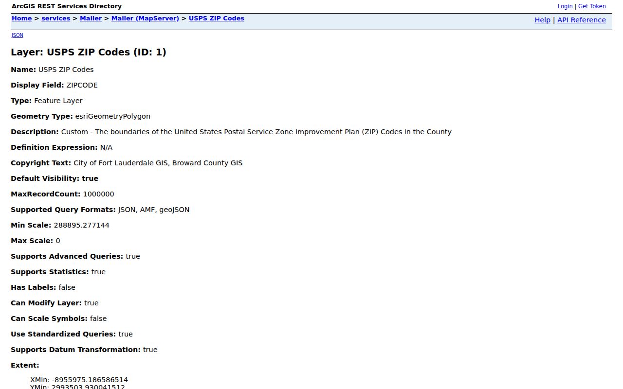
Use that postal layer only after the street and parcel are resolved. A mailing-city label alone cannot choose the right municipal custodian.
Fort Lauderdale Voters by Street
The Broward Supervisor of Elections maintains an individualized lookup, but it is not a whole-street browser. A lawful street analysis uses the registered-voter report request route. Public fields can include name, address, registration date, party affiliation, precinct, districts, contact fields, and voting history. History means participation, never a marked choice.
Social Security numbers, driver-license or state-ID numbers, and the registration source are excluded. Signatures may be viewed but not copied. Address Confidentiality Program participants and qualifying exemption holders are protected. During the office's voter-system transition, a temporary statistics-search interruption should lead to the records desk, not a claim that no voter exists.
The absence of a voter row proves little. The person may not be registered, may be protected, or may have a status that needs direct review.
Older Fort Lauderdale Streets
For the historical layer, a reverse section organizes listed adults by street and house number. Broward Main Library has a searchable city-directory database on the fifth floor, and the Library of Congress supplies Fort Lauderdale telephone books from January 1941 through February 1947. The digital item contains 884 page images. Telephone books list subscribers, addresses, and numbers, but can omit non-subscribers.
A deeper account of publishers, entry marks, and shelf access belongs in the Fort Lauderdale city directory collections. For street work, record the exact spelling and house number, inspect nearby entries, and compare adjacent years. Pair the result with the tax or deed chain before treating it as evidence of a past resident.
Limits of Fort Lauderdale Street Directories
A public street directory cannot show everyone inside a home. Tax rolls name owners, not renters or all members of a household. Voter files omit people who are not registered and suppress protected voters. Reverse directories omit unlisted subscribers. DMV addresses are restricted by federal law, and utility account data may be confidential or security-sensitive.
Use source words in every note: owner, mailing addressee, registered voter, permit applicant, responsible party, or listed subscriber. Current occupancy should not be inferred from a single stale row. A second dated source can test identity, but it cannot turn a limited record into a complete resident list.
Lawful use. Fort Lauderdale address records support personal, civic, and family research. Never use them to stalk, harass, threaten, or evade a protected address.